Extract environmental data from MODIS
Extracting environmental data (such as temperature, land cover, and NDVI) from the web can be very challenging. Many platforms are available, such as Copernicus and MODIS.
These platforms offer a wide range of products that can be highly heterogeneous for a single variable, meaning they may differ in spatial/temporal resolution and extents. They also come with their own routines, which can be technically complex and resource-intensive.
This brief document describes a simple and efficient, though likely not yet perfect, method for extracting certain environmental variables from MODIS.
Two approaches are possible:
- Use the package
MODIStspin R.
Be aware that the package may have installation issues on Linux, and it is no longer maintained. Additionally, not all products are available. When it does work, it is still very useful for extracting MODIS data within a specific spatio-temporal window.
- Use the command line to download the data based on the URL link where the data is stored.# Extracting data with
MODIStsp
Dowload MODIS data with the package MODIStsp
To install the package use:
remotes::install_github("ropensci/MODIStsp")The base function of the package is MODIStsp().
MODIStsp(
  gui = FALSE, # Do not open GUI before processing
  spatmeth = "tiles", # Type of spatial extent
  out_folder = "folder/", # Folder to store the data
  start_x = 17,end_x = 18, # Geographic rectangles/tiles to download the data
  start_y = 3,end_y = 4,
  start_date = "2000.01.01", # Beginning of the time series
  end_date = "2020.12.01", # End of the time series,
  selprod = "Vegetation_Indexes_Monthly_005dg (M*D13C2)", # Product to download
  bandsel = c("NDVI"), # MODIS layers to be processed
  quality_bandsel = NULL,
  indexes_bandsel = NULL,
  user = "mstp_test", # put your ID
  password = "MSTP_test_01", # and login
  verbose = TRUE,
  parallel = FALSE
)
The argument spatmeth allows you to select the spatial extent of the data to download. It can be defined by a set of tiles that reference rectangles covering the world (specified through the arguments start_x, end_x, start_y, end_y) link. It can also be a bbox or a shapefile contained in a file.
selprod is the product to select (variable, spatial, and temporal resolution). All products available through MODIStsp can be obtained with the function MODIStsp_get_prodnames().
You will need an ID and a login to extract the data. Here we took test codes.
The products will be available in the folder/ specified in the function. They provide a .RData file with all the extracted rasters (usually one per time step) or, alternatively, one raster per time step in .tiff (or a similar) format.
Dowload MODIS data from the command line
The package is quite limited in terms of available products (for example, there is no land cover data) and is no longer maintained, so there are several bugs (e.g., during installation).
A more robust way to extract the data is to use the data access portal link. The key point is to find the right product in the catalog [catalog link].
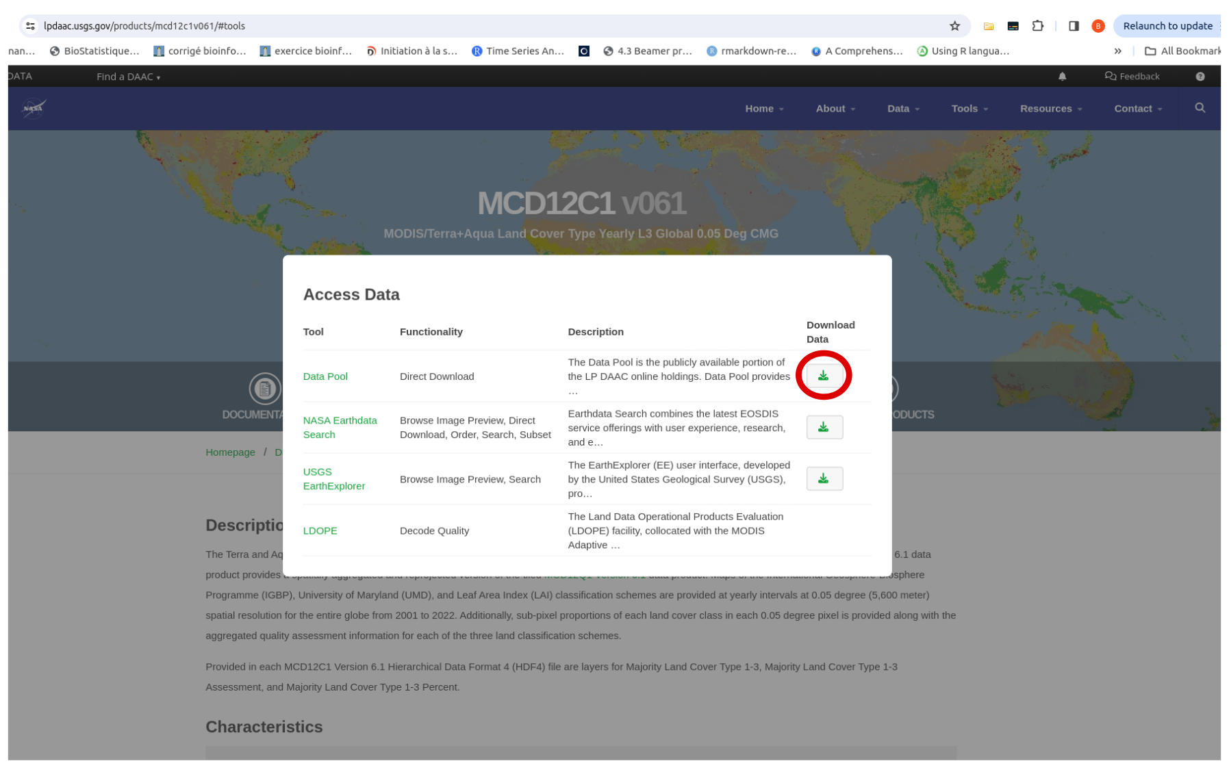
After finding the product, such as land cover > click on “Access the data” > click on the download icon in the “Data Pool” to directly download the data.
This redirects you to a page with all the files related to the product (which can be extensive).
For land cover data, here is the link https://e4ftl01.cr.usgs.gov/MOTA/MCD12C1.061/.
The following steps are summarized for Ubuntu. Detailed instructions for different operating systems can be found here.
First, you will need to create a user profile at https://urs.earthdata.nasa.gov/home.
Next, create a .netrc file in your home directory.
Then, write the following lines with your earthdata.nasa ID and password in the terminal.
echo "machine urs.earthdata.nasa.gov login YOUR_USERNAME password YOUR_PASSWORD" > ~/.netrc
chmod 0600 ~/.netrc
Use wget to download the whole data:
wget -r -np -nH --cut-dirs=3 --reject "index.html*" --no-check-certificate https://e4ftl01.cr.usgs.gov/MOTA/MCD12C1.061/Here is an explanation of the argument:
-r: Recursive download.
-np: No parent, prevents wget from following links to the parent directory.
-nH: Disables the creation of host-prefixed directories.
–cut-dirs=3: Removes the first three directory levels from the downloaded file paths.
–reject “index.html*”: Excludes the index.html files from the download.
–no-check-certificate: Prevents wget from checking the SSL certificate (useful if there are issues with certificate validation).
It will download the data in .hdf format files. To download data for only a single year (e.g., 2001), navigate through the file tree by entering:
wget -r -np -nH --cut-dirs=3 --reject "index.html*" --no-check-certificate
https://e4ftl01.cr.usgs.gov/MOTA/MCD12C1.061/2001.01.01/
Files will be downloaded to the home directory. To download them to a specific folder, navigate to the desired directory using the cd command, choose the directory of interest, and run the previous command. Alternatively, you can use the -P argument.
wget -r -np -nH --cut-dirs=3 -P "file_name" --reject "index.html*" --no-check-certificate https://e4ftl01.cr.usgs.gov/MOTA/MCD12C1.061/2001.01.01/This option should be preferred over the R package MODIStsp because it provides access to more products and does not depend on package maintenance.